
Update: January 2023
Molonglo River Corridor work around Whitlam does not currently impact upon this route, with Namarag reserve open and construction for Whitlam well managed around the gravel route. The number of gates to lift over has dramatically reduced, and there is now a rough track option to connect to Stockdill Drive! The route described here remains a good outing, but details on connecting to Stockdill Drive are in Full Molonglo.
The Molonglo Valley is a less well-known place to explore off-road in Canberra. Following the northern bank of the Molonglo River from just below Scrivener Dam, the gravel tracks are favourites of folk in Weston Creek and the Molonglo Valley. A good route from which to see kangaroos and other wildlife, it is also regularly changing as the ACT develops the corridor with new parks, Coppins Crossing upgrades and the new suburb of Whitlam. Hopefully this will only make this escape from the city even better.
Crossing the Molonglo

It is easy to access this ride from the cycle path around Lake Burley Griffin: the Komoot route leaves the lake loop, crossing Yarralumla Creek. Passing the old woolshed and equestrian park, the ride crosses the river at the equestrian trail, clearly marked on the bike path. There are a few crossings in addition to this one which is important and this one is particularly low and may not be possible to use if Scrivener Dam is releasing water after rain. Should the crossing be impassible, it is possible to start back at the dam next to the zoo – there is a small car park from where it is possible to get down to the trail. There is also a much higher one north of Weston Creek pond (see Full Molonglo).
Having crossed the river, the trail follows the Molonglo until Coppins Crossing Road. A worthwhile diversion is to ride up Barrer Hill. Whether you do this detour or not you’ll see some unusual poles and tree trunks near the trail. Canberra’s (at times questionable) track record with public art is part of the explanation, but not solely so – the poles and trunks are wildlife habitat structures established as part of the Restoration Project of the area.
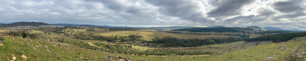
Detour up Barrer Hill
Barrer Hill provides panoramic views of the new suburbs of Molonglo and across the valley. The hill also provides a great panorama of the pine plantation between the Molonglo and the arboretum, through which there are a number of gravel trails to explore. One of the advantages of Boundary Road is that it is possible to ride directly into the arboretum, rather than having to lift your bike over a gate – see Stromlo to Arbo for more information on this.

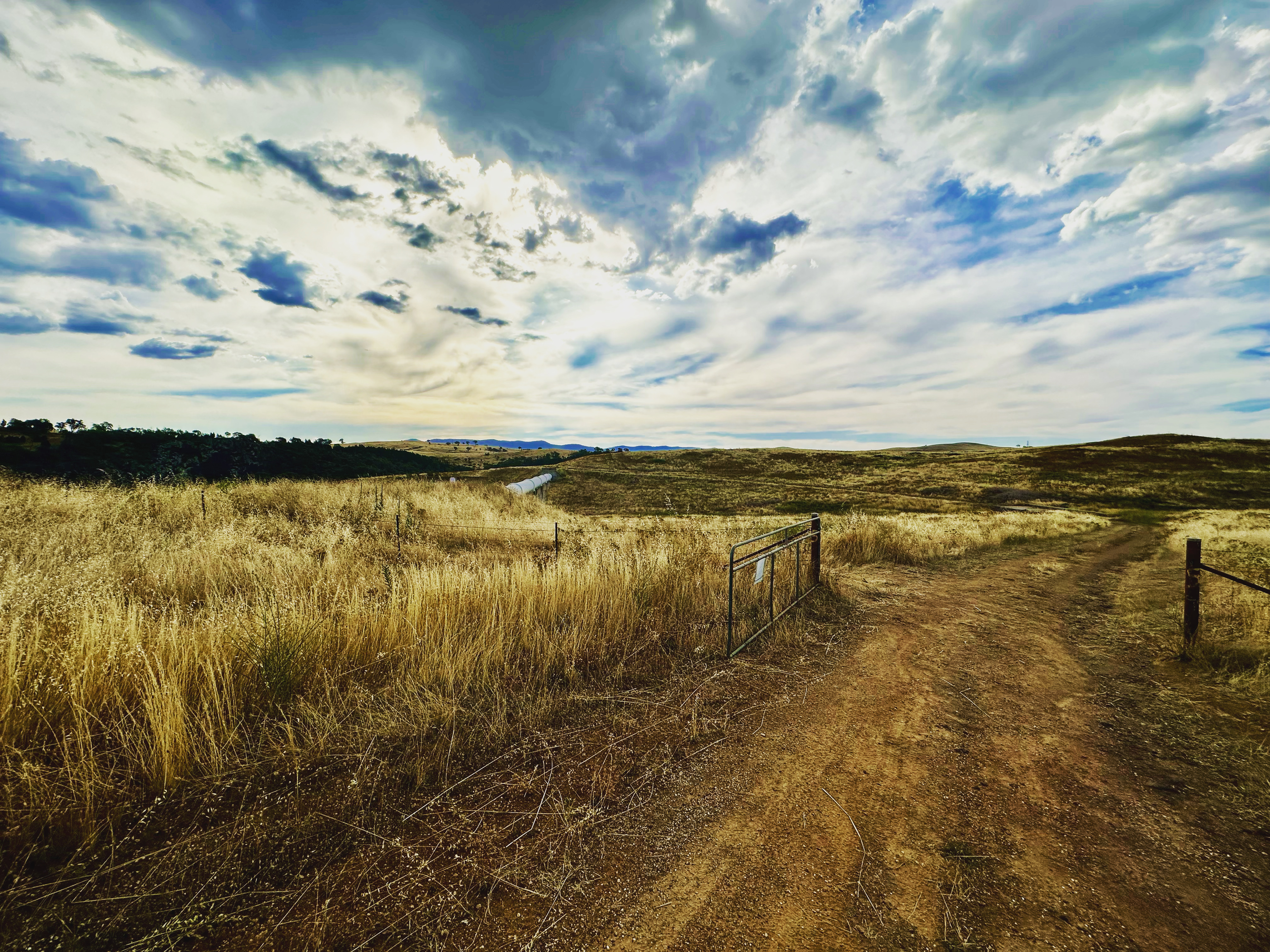
After Barrer Hill, there is a gate to cross before a lovely run through to Coppins Crossing Road, and the start of Pipe Flat Road.
Whitlam suburb works
For around 12 months in 2020-2021, the Molonglo River Corridor was closed west of Coppins Crossing Road. After completion of the Namarag Reserve, it is now possible to continue on this route. At November 2021 the main gate was not bike / pedestrian friendly, but there is a small bike / pedestrian gate to the right – a great improvement on having to lift a bike over!

Detour to Butters Bridge

After Coppins Crossing Road, it is worth a detour to Butters Bridge for a view of the river. Strangely isolated, it stands waiting for more than the occasional walker and cyclist whilst performing its prime function as a sewer pipe! Hopefully the Namarag park area changes this soon. In addition to the view, this bridge is a great way to adjust the mapped Komoot: to head to Stromlo Forest Park via the trails around the suburb of Denman Prospect, or to return to Canberra via on road cycling (eg John Gorton Drive to Cotter Road).
Pipe Flat Road, then back to the Aboretum

Beyond Butters Bridge, Pipe Flat Road proves that sewerage maintenance infrastructure can be a gift to gravel cycling. Along this road you will be rewarded with some great views of local grass land, river-side cliffs and the Brindabella Mountains. Unfortunately, this brilliant ride is abruptly (and rather colourfully) curtailed by a local property.

It would be amazing if somehow arrangements could be made so that less-than adventurous cyclists could get through to Stockdill Drive on something other than a pretty challenging cross-country route. [Note: this single-track / rough track has now been travelled. Stay tuned for more details!]

Heading back towards Canberra, it is worthwhile returning through the National Arboretum. After the 2003 bushfires burnt through pine plantations in this area, the growing forests and gardens are becoming increasingly interesting in their own right. Whether this is your thing or not, it is great for cycling and awesome views. Filled with gravel roads and single tracks, you could spend hours here – see the CyclingGravel article about how to have a full single track adventure around the Arbo. For shorter rides, highly recommended is part or all of the Mountain View Track. Whatever you decide, from here it is a gentle ride back to the Lake Burley Griffin loop.

Details of this ride
Hints and tips
- A gravel bike is good for this ride, although some of the track near Barrer Hill is getting quite rough. It is even ok if you are planning to explore the single tracks in the Arboretum as these are very well maintained and quite smooth.
- Gates – I used to have to put my bike over a gate nine times, and these gates still exist. There have been some significant changes with the Whitlam works, and this has been reduced to three that are actually closed (the pictured above at Barrer Hill, the eastern side of Coppins Crossing Road, and one of the seven gates on Pipe Flat Road on the southern edge of Whitlam). Most of the gates were previously on the Whitlam side of Coppins Crossing Road, and almost all are now always open, but could still be closed for stock grazing.