
Many Canberra cyclists are familiar with the ride to Lake George. For the hardcore this can be via the Federal Highway verge, but for the majority the combination of the Federal Highway service road, Old Federal Highway and Hadlow Drive provide a route to Gearys Gap. From this point, however, the only option to proceed to Collector is via the highway – offering a flat route with generous verge, but noisy and not terribly pleasant.
For gravel grinders there is an alternative via Gundaroo – limited traffic, amazing views, and some fun descents. And, if you are going to go this far, there is the option of turning the ride into a full Lake George circuit.
Leg 1: Canberra to Gundaroo

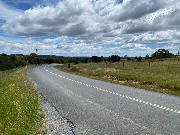
Sutton Road, heading towards Gundaroo
The most direct route to Gundaroo is via Sutton Road, although the exact route that is best for you will depend upon where you are based in Canberra. The route map in Komoot below shows my route – travelling up the under-rated Gungahlin Drive and then out via Mulligans Flat Road. Whether from this direction or via Sutton itself, Sutton Road has frequent but not constant traffic. Whilst some parts (such as the part pictured above) have a narrow verge, others have none. Thankfully the road has great visibility, which means traffic has plenty of warning you are there and can also easily see when it is safe to pass.
As an alternative route to Gundaroo incorporating more distance but great gravel, you could consider Tallagandra Lane, Dicks Creek Road and Yass River Road. See Gundaroo Gravel for more detail.
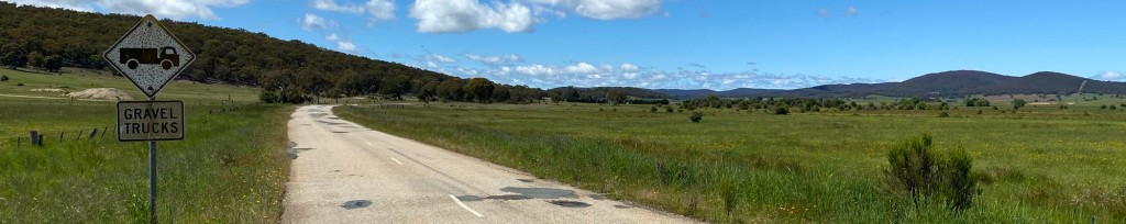
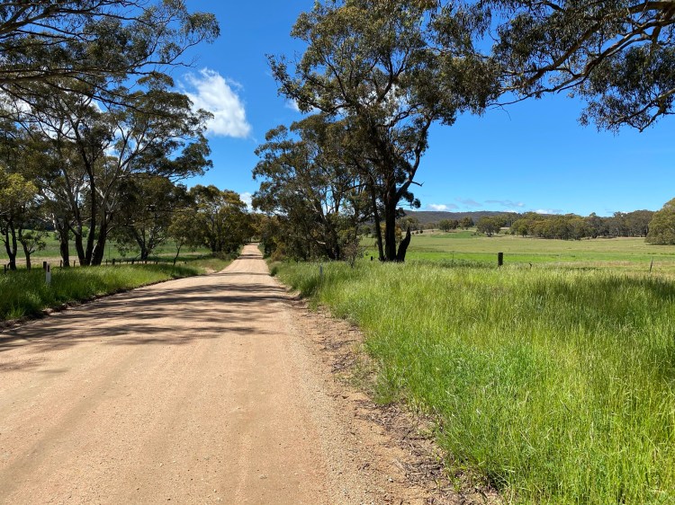
Leg 2: Gundaroo to Collector (~25km)
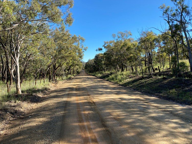

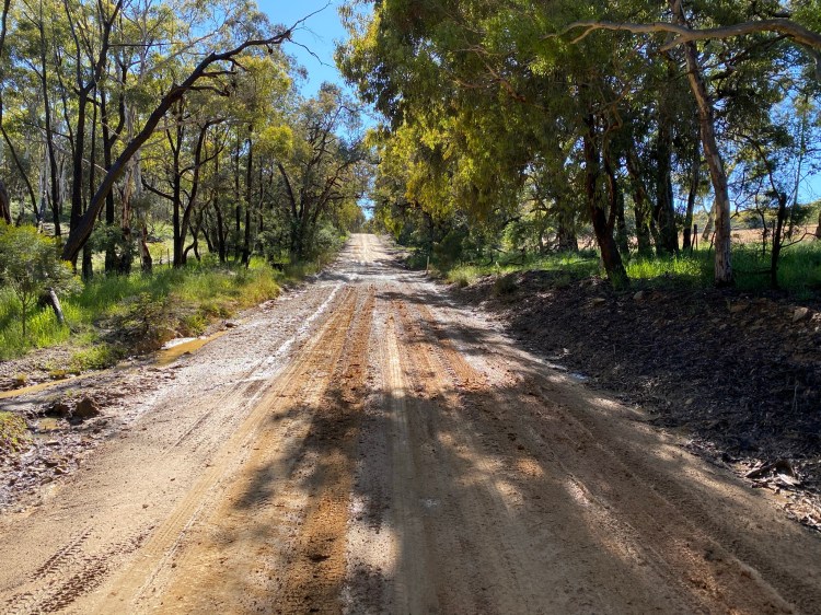
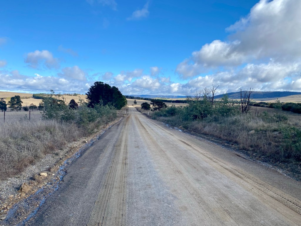
Marked Tree Road provides the longest gravel segment of the route. Overall, the road is of the typical standard for the area: reasonably well maintained with the occasional area where water run-off or rutting requires a little caution. Be forewarned, however: if it is wet proceed knowing there are places where the road can be quite muddy. Based upon experience of having ridden this route a few times, it is really only an issue with significant rain within 24 hours of use. Further, these are not significant stretches, and it is absolutely possible to ride. Having said that, you can pick up a lot of mud – there are two or three patches where you will be grateful for decent clearance on your bike. Furthermore, the mud is some of the horrible sticky clay that does occur in some places around Canberra – and it will stay on your bike for the rest of the trip. If this is not for you, go when it is dry or be prepared to carry your bike over some patches and get muddy shoes.

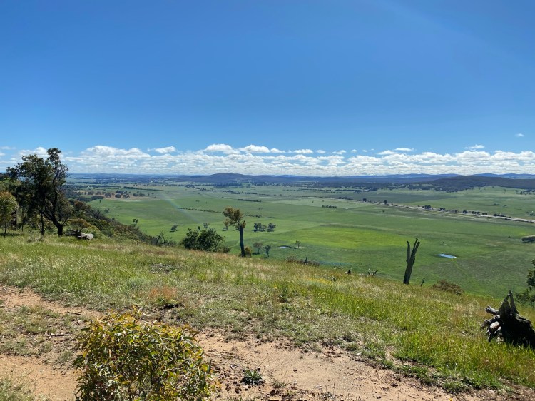
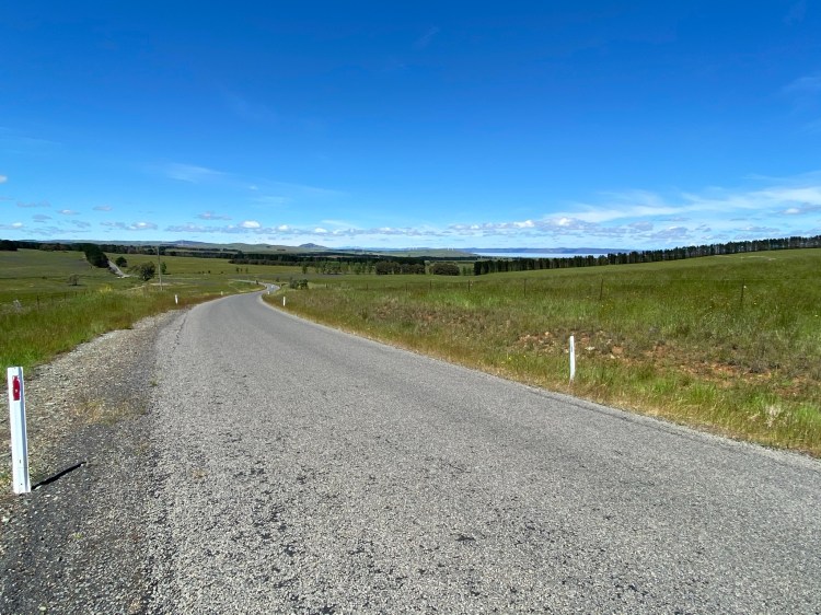
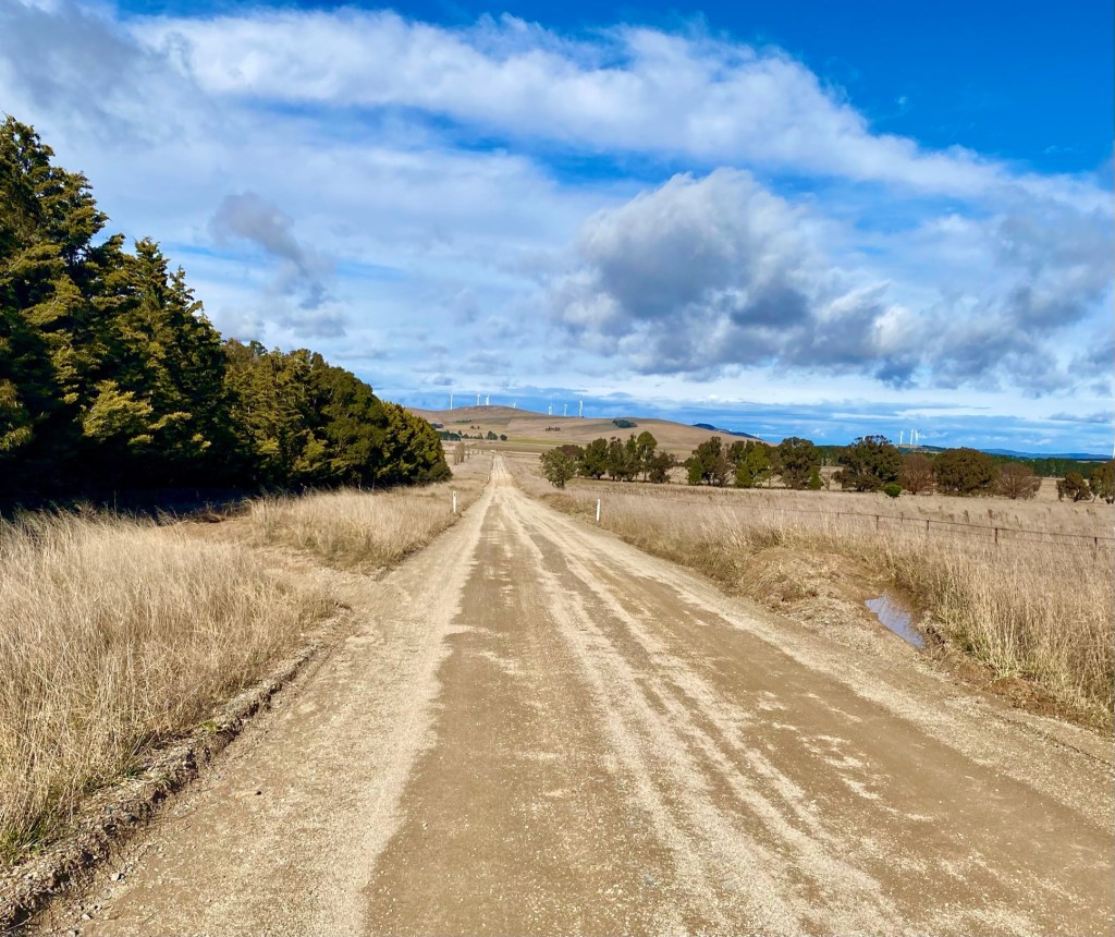
Having completed most of the climbing, it becomes apparent that the road is running along the top of the ridge above Lake George and the Federal Highway. This opens up in places for stunning views.
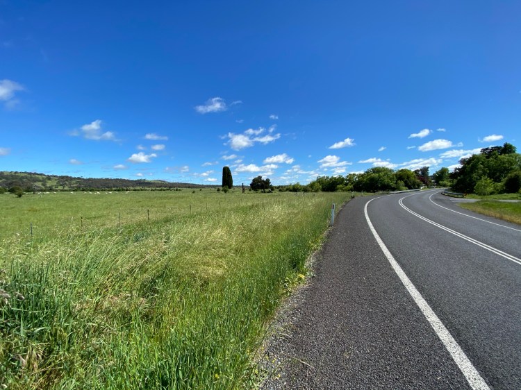
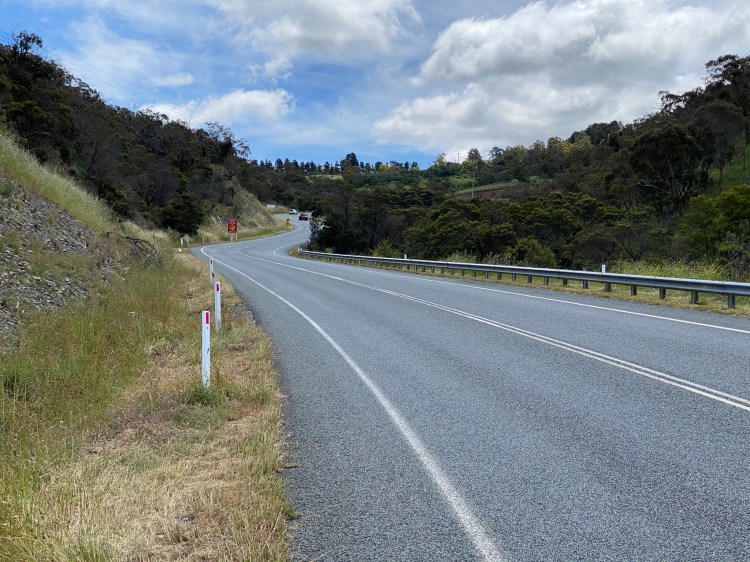
Federal Highway & Collector 
Lake George
From here, the road is undulating until the intersection with Collector Road, where the tarmac returns. This is a blessing as from here there is a -10% descent for about a kilometre before flattening out for the flood plains.
Entering town 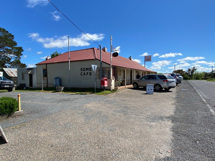
Some Cafe is excellent
One of the best reasons to visit Collector is Some Café – one of the very best regional cafes you could hope to find. With outside and inside seating options, this is a great location for a morning mid-ride coffee. The website menu is accurate, but what the menu doesn’t reveal is the cabinet of very tempting and tasty sweet treats in store. Totally OK in the middle of a long ride!
Leg 3: Collector to Bungendore (~56km)

Heading out from Collector and straight across the Federal Highway dual carriageway, Collector Road is a lightly trafficked route until the intersection with Currawang Road. It has around 6km of gravel: smooth and reasonably flat. Once past the Currawang Road intersection there are some lovely sweeping descents and climbs, as well as fleeting views of Lake George.

There are two options as to how to proceed from here: take Taylors Creek Road on the westerly side of Woodlawn Wind Farm, or continue on Collector Road to Bungendore Road. Taking Taylors Creek Road has the advantage of avoiding a part of Collector Road that seems to be a source of a limited number of (well mannered) semi-trailers. I’ve included more on the nature of the Taylors Creek option below.
Regardless of the route, you do end up on Bungendore Road, which is one of the busiest parts of the route. There is nothing wrong with it per se, and it offers farmland views and a nice descent into Bungendore, but on a windy day can be a bit exposed for the final 15km. It is also fast and not necessarily always polite traffic.
Once in Bungendore there are various cafes to provide lunch. I’m sure there is a range of opinion on this, but I do like the coffee and food options at The Gathering.
Alternative: Taylors Creek Road
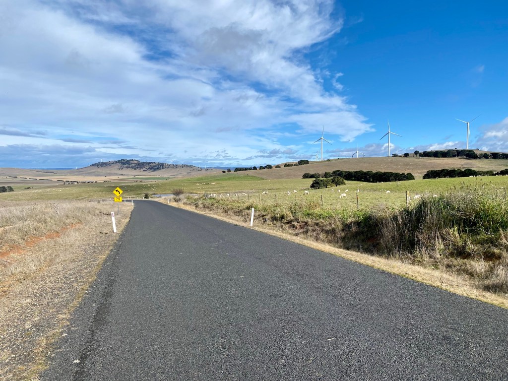
A recommended alternative, provided there is no minor flooding, is Taylors Creek Road. Starting unsealed, it descends to a floodplain before heading back into the hills amongst the wind turbines. It also is sealed for approximately half of the 17km road. This makes for a lower traffic and slightly shorter loop, so unless you plan a Tarago pit-stop (or there has been a lot of rain) this is my recommended choice.
Leg 4: Bungendore to Canberra
Smiths Gap 
Norton Road
Heading out of Bungendore to the west (continuing via Bungendore Road), the route passes the southern tip of Lake George before climbing up Smiths Gap. This road gets a reasonable amount of traffic, and the stretch before the climb has limited verge although thankfully good visibility. Smiths Gap has good verge for the ascent and is a short but sharp climb. Descending on the other side it is not far until the turn into Norton Road.
Norton Road near Contentious Character 
Descent to Sutton Road
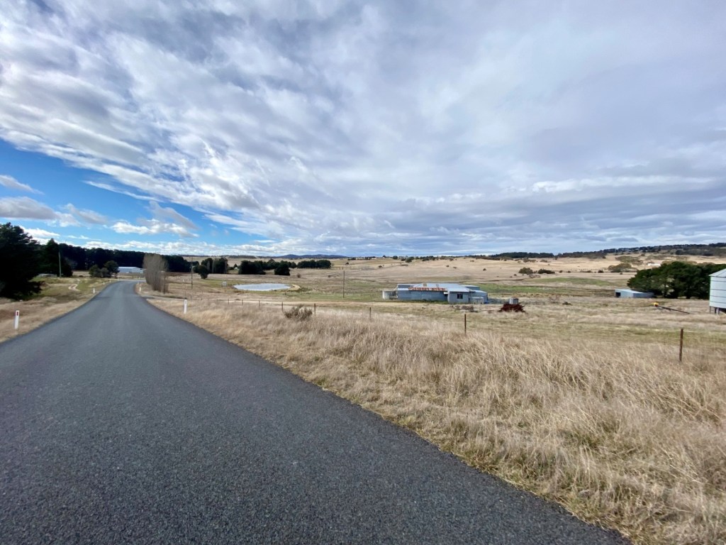
Norton Road provides a respite from traffic compared to the preceding 35km. It is an undulating route passing part of the Wamboin commuter belt. The road passes two wineries if you are up for a visit (Contentious Character and Norton Road Wines, both of which have dining options some days of the week), which might be an option worth thinking about on a summer weekend afternoon.
The last 10km of the ride to Pialligo Avenue is downhill – steeply to Sutton Road and then more gently from there. Sutton Road is ok for cycling, but not brilliant – there are some areas with no verge so take care as there is frequent traffic.
Alternative return to Canberra: via Hoskinstown, Briars Sharrow, Captains Flat Roads

Hoskinstown Road
If the ride up Smiths Gap and Sutton Road are not your thing, I can recommend the alternative of using Hoskinstown, Briars Sharrow and Captains Flat Roads. The first two roads have very light traffic, and are certainly much safer than any attempt to cycle on the Kings Highway. Captains Flat Road is busier, but also has a decent verge for the vast majority of the route. Not to be ignored at the end is the fast and fun descent into Queanbeyan!


