
If you like gravel, tarmac roads are usually part of the journey. A quiet country road or well-planned city cycleway is absolutely fine with me. A highway? If at all possible, no thanks.
The Murrumbateman area is one I’ve explored by car – wineries, farms and great gravel roads. Unfortunately, the most direct route involves a busy highway. Whilst I might consider such a trip if the verge is generous, this is not the case on the Barton Highway. I’ve been intrigued by the possibility of cycling a loop from Canberra via Mountain Creek and Murrumbateman Roads, avoiding the highway altogether. Route planning tools say you can’t unless you ride almost entirely to Yass (see Yass on-road day trip), missing some of the best gravel roads. But it turns out that you can. It makes for an awesome day out.
Uriarra, Fairlight and Mountain Creek Roads

Those familiar with the Cotter Uriarra loop would know that at Uriarra crossing there is a clearly marked route to Wee Jasper and Yass. Even if you are not interested in a long-distance gravel ride, cycling on Fairlight and Mountain Creek Roads is a scenic countryside pedal. Infrequent and courteous traffic is the only interruption to undulating hills, picturesque farms and mountain views. Other than perhaps an enthusiastic local border collie not used to cyclists.
Glenrock Road


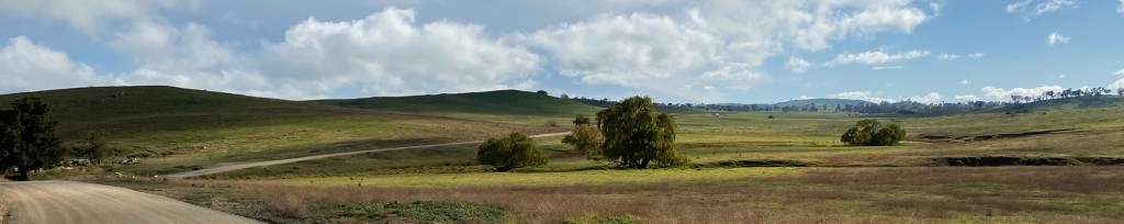
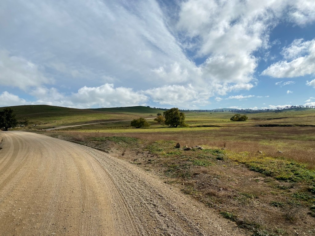
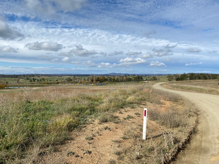
Glenrock Road starts the gravel journey, and of all the roads on this trip appeared to be the least travelled. After a rocky beginning, the road starts to traverse farming properties, rolling up and down hills and crossing several livestock grids. There are some extremely fun downhill sections which would be amazing on a hardtail MTB, but caution is recommended for gravel bike tires as there are many loose rocks of quite a reasonable size – waiting to provide a pinch flat if you are tubed and unfortunate.
Cavan Road, and crossing the Murrumbidgee


At the end of Glenrock Road, Cavan Road is better maintained and more regularly travelled. There is a faded No Through Road sign, but the route continues in a similar vein – crossing farmland with some short steep descents and ascents as the road heads towards the Murrumbidgee. At the intersection with Esdale Road there is a clear No Through Road sign on that road, but no such sign on the Murrumbidgee River crossing. This is where the online mapping tools seem to think it is not possible to continue, but there are no signs or gates to stop or discourage you from doing so.
Across the river, the road soon starts up a climb – the longest and steepest of the ride. Towards the top (and where mapping tools recognise the road again), there is evidence of regular truck traffic (for example, there are truck guidance signs and UHF channel information). This seems odd for a “no through road”.
So, what is the story with this route? Are you within your rights to travel this road, or is it private property? I was passed by two vehicles whilst riding without any questions being asked, and these seemed local through traffic. The route has no gates or signage saying the road is private, unlike some adjoining fences and gates. The climb up from the Murrumbidgee even merits a Strava segment! In short, I don’t know. I suspect that whatever the road’s status, an occasional bicycle is ok but a sudden increase in motorized traffic might change the situation quickly.
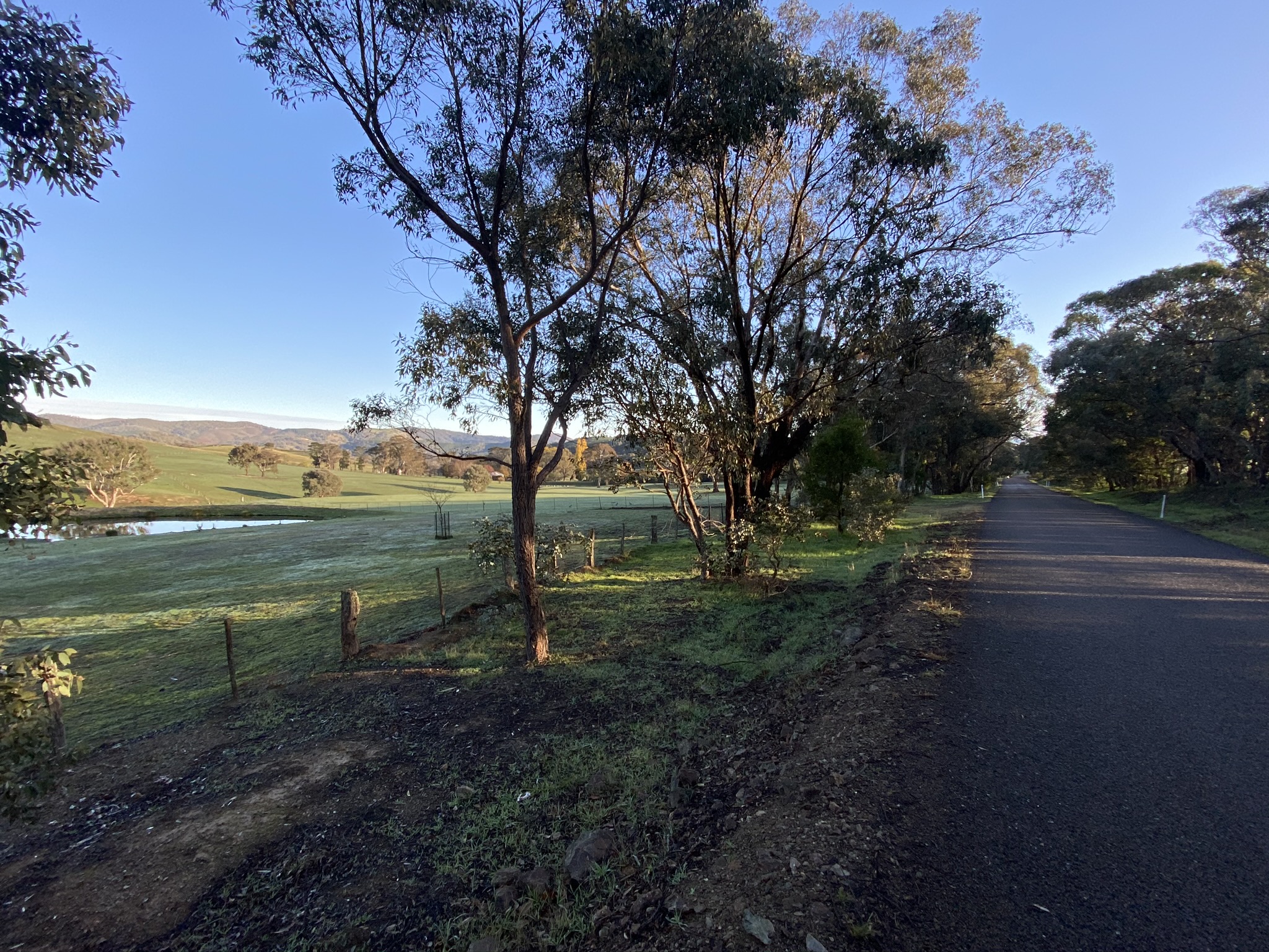
Dog Trap Road and Murrumbateman

Dog Trap Road is a beautiful country gravel road that is normally well maintained. After around 12km of rolling hills, you know that Murrumbateman is approaching when you can see rural lot numbers marking where Canberra commuters will perhaps soon be taking up residence. Soon you can be back on the tarmac at Isabel Drive and running into central Murrumbateman.
Before heading out on this ride I highly recommend more planning: take the time to consider whether you want to drop in on a winery (or two or more!). Some research will help to confirm when each is open, what is on offer, and whether advance booking is recommended. Without any adjustment to the route, three wineries are passed prior to Murrumbateman (Gallagher, Granitevale, and Shaw) and two afterwards on Murrumbateman Road (Dionysus and Four Winds). These offer diverse choices depending on the date and timing: wine tastings, cheese plates, light meals, pizzas and up-market dining. In addition to these five, there are a number of other wineries nearby that a quick route adjustment will accommodate, and even a Meadery!
On my ride most of these options were closed, so I availed myself of a takeaway pecan pie and coffee from the Village Café and enjoyed a break in the Jones Park Rest Area. This area has public toilet facilities but unfortunately the water taps do not offer drinking water. There is a fresh water tap at the Caltex petrol station.
Return to Canberra

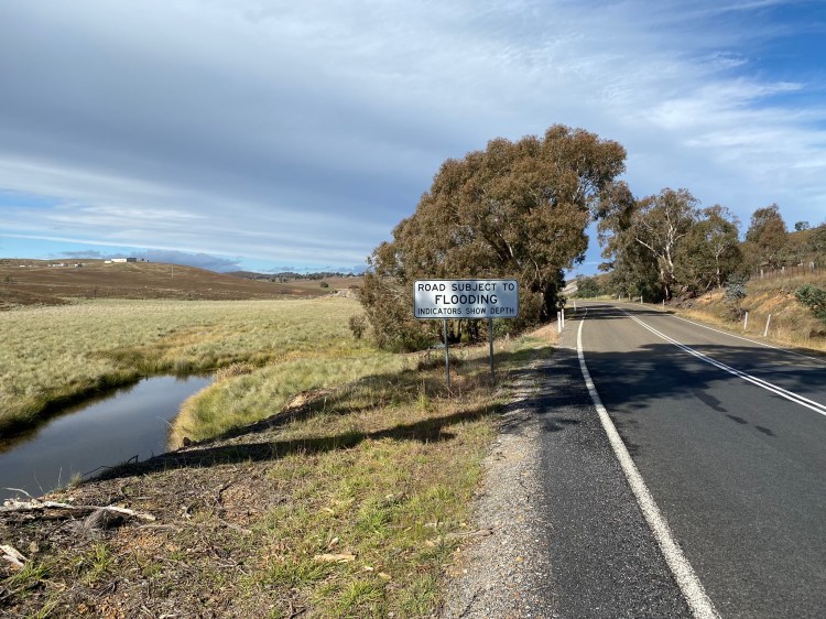
Murrumbateman Road is the busiest road of the route, carrying regular traffic travelling at high speed. In many places there is a decent paved verge, but at no stage does the road feel an unsafe place to be cycling. It is nice to soon return to gravel on Tallagandra Lane, although being Australian I was intrigued by the possibilities offered by Dicks Creek Road. See Gundaroo Gravel and Gunning Gravel where I have satisfied my curiosity.

Tallagandra Road was the most corrugated road of the trip, although like all gravel roads this is likely to be a reflection of time since the most recent visit of the council grader. It is a good quality road – the only parts to be particularly cautious of are the entry and exit to a couple of concrete floodways.
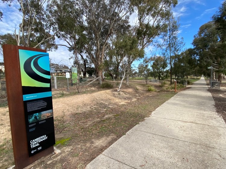
Re-entering the ACT at the top of Mulligans Flat Road, there are a number of ways to get back to the city. The mapped route is a rapid on-road one, albeit subject to regular traffic light interruptions. There are a number of alternatives, including cycleways. At a minimum it is nice to exit the road onto the old Gundaroo Road, which is included on the Komoot route. For those after an even more epic gravel experience, I can highly recommend following the Centenary Trail through Mulligans Flat Reserve and Goorooyarroo Nature Reserve, then continuing through Mount Majura and Mount Ainslie Nature reserves. If that is your plan, you can restock water supplies at the picnic stop before leaving old Gundaroo Road, or alternatively have a coffee (or beer) break at one of my favourite café stops: Frankie’s at Forde shops (including excellent toilet facilities).

Details of this ride
Hints and tips
- A gravel bike is perfect for this ride.
- As discussed in the article, it is worth having a plan for where you’ll have your major breaks. Where to stop depends a lot on when you start the ride, and the time of year. I set off pre-dawn and had morning tea at the Murrumbateman Village Café, ending up back in Canberra for a late lunch. In summer time, it would be divine to time things for a solid morning ride, lunch in a Murrumbateman winery, followed by a beer at Frankie’s in the late afternoon.
- I cycled on a cool May day. The route has stretches of limited shade, so think carefully about sun protection and hydration if riding in summer.


